





Geophysical Data Analyst

Spectrum
Lymington, UK
1 day ago
Apply on www.collegerecruiter.com
Prepare application

Role details

Contract type
Permanent contract
Employment type
Full-time (> 32 hours)
Experience level
Experienced
Experience required
2 years minimum
Working hours
Regular working hours

Tech stack

Microsoft Word Microsoft Excel Geographic Information Systems ArcGIS (Software) Big Data Python (Programming Language) Microsoft Office Microsoft Software Quantum GIS (QGIS) SONAR (Symantec) Spatial Data Infrastructures Data Processing
+3 more
Scripting Enterprise Software Applications Data Management

Job description

Position Overview

Spectrum Geosurvey specialise in coastal geophysical surveys, supporting a wide range of clients in the offshore renewables sector. We have a proven track record delivering the highest-quality hydrographic and geophysical survey data. Spectrum Geosurvey are seeking an enthusiastic and dedicated individual to join our growing team based in our Lymington office.

As a Geophysical Data Analyst, you will be responsible for the analysis of geophysical data, making geological interpretations of the seabed, identifying hazards to offshore assets, charting results and survey report writing. The role will also involve processing geophysical datasets (training provided). It is a varied, office-based role and great opportunity to develop different skills and build key industry-related skills and gain exposure to a variety of projects in the offshore renewable energy sector.

Successful applicants shall have a background in geology or geophysics (or other relevant Earth sciences) and GIS software such as QGIS or ArcGIS. The candidate will have a base knowledge of shallow marine processes and be able to identify geological features.

Experience working with marine survey data, including side scan sonar, magnetometry or seismic data is necessary.

Supported by an experienced and committed team of Geophysicists, the Geological Data Analyst will develop their skill set to carry out the following tasks within our growing company.

Role Responsibilities

  • Seabed sediment and morphology interpretation and mapping in GIS software
  • Identify and digitize hazards to offshore asset construction
  • Shallow geological interpretation and mapping using seismic data sources
  • Chart data in GIS software, as well as generate report images and maps
  • Write geophysical survey reports
  • Assist in maintaining a high quality and consistency of data processing and deliverable creation
  • Data quality control and data assurance ensuring that it complies with the project scope of work
  • Assist with data archive and data repository management, ensuring safe storage of a large variety of data formats
  • Use Microsoft applications such as Excel and Word, to maintain accurate processing records
  • Take the initiative in solving and implementing solutions
  • Understand and work to company QHSE standards
  • Processing geophysical data where necessary

Required education/experience & attributes:

  • Degree or equivalent in a relevant subject such as Geology, Geophysics or other related marine or earth science
  • At least 2 years industry experience within a similar or transferrable role is necessary
  • Strong working knowledge of GIS and spatial data
  • Familiarity interpreting marine geophysical and geotechnical data to characterise the seabed
  • Competent in the use of all Microsoft Office applications including Word and Excel.
  • Strong technical report writing
  • Excellent data management and coordination skills to handle large volumes of data
  • Ability to work both independently and as a team, have a can-do, proactive attitude and a strong verbal communication skillset
  • High attention to detail while under pressure to ensure all relevant information is accurately reported
  • Ability to take the initiative, to solve problems and troubleshoot where required
  • Able to work in the UK

Desired but not essential education/experience & attributes:

  • Working knowledge and understanding of multibeam bathymetry, side scan sonar, magnetometer and seismic systems and/or previous experience using geophysical software packages such as SonarWiz, Oasis Montaj, RadExPro and IHS Kingdom
  • Experience with a scripting language (e.g. Python)
  • Full valid UK driving license

Company Benefits

  • 33 days of annual leave per year (including Bank Holidays)
  • Private Medical Insurance Programme (Bupa)
  • Pension 5% Matched
  • Continuous training and development opportunities
  • Cycle to work scheme (salary sacrifice)
  • Modern, environmentally friendly office with sit down/standing desks
  • An Employee Assistance Programme, providing trained wellbeing and counselling practitioners and 24/7 telephone support
  • Free eye tests
  • Free team lunch on a Wednesday
  • Great team culture
  • Sport socials

How to Apply:

Interested applicants should submit a CV and a cover letter outlining their suitability for the role to .

Requirements

Successful applicants shall have a background in geology or geophysics (or other relevant Earth sciences) and GIS software such as QGIS or ArcGIS. The candidate will have a base knowledge of shallow marine processes and be able to identify geological features.

Experience working with marine survey data, including side scan sonar, magnetometry or seismic data is necessary., * Degree or equivalent in a relevant subject such as Geology, Geophysics or other related marine or earth science

  • At least 2 years industry experience within a similar or transferrable role is necessary
  • Strong working knowledge of GIS and spatial data
  • Familiarity interpreting marine geophysical and geotechnical data to characterise the seabed
  • Competent in the use of all Microsoft Office applications including Word and Excel.
  • Strong technical report writing
  • Excellent data management and coordination skills to handle large volumes of data
  • Ability to work both independently and as a team, have a can-do, proactive attitude and a strong verbal communication skillset
  • High attention to detail while under pressure to ensure all relevant information is accurately reported
  • Ability to take the initiative, to solve problems and troubleshoot where required
  • Able to work in the UK, * Working knowledge and understanding of multibeam bathymetry, side scan sonar, magnetometer and seismic systems and/or previous experience using geophysical software packages such as SonarWiz, Oasis Montaj, RadExPro and IHS Kingdom
  • Experience with a scripting language (e.g. Python)
  • Full valid UK driving license

Benefits & conditions

  • 33 days of annual leave per year (including Bank Holidays)
  • Private Medical Insurance Programme (Bupa)
  • Pension 5% Matched
  • Continuous training and development opportunities
  • Cycle to work scheme (salary sacrifice)
  • Modern, environmentally friendly office with sit down/standing desks
  • An Employee Assistance Programme, providing trained wellbeing and counselling practitioners and 24/7 telephone support
  • Free eye tests
  • Free team lunch on a Wednesday
  • Great team culture
  • Sport socials

Apply for this position

This job is hosted externally. Click below to view the full posting and apply.

Apply on www.collegerecruiter.com
Prepare application

Good distractions

Talks and stories from around this role — technically off-topic, practically not.

3:31 min

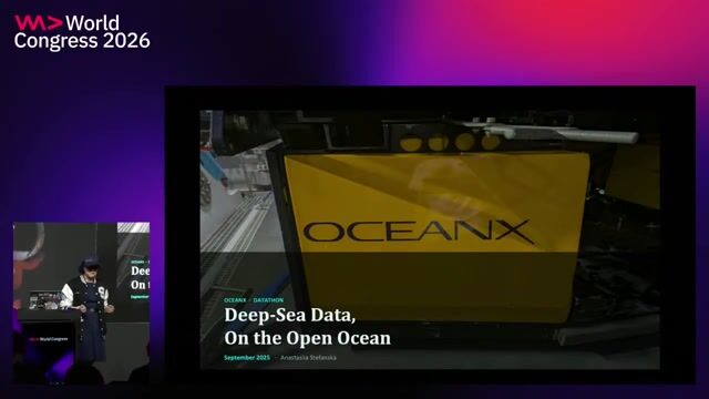
Unmanned scanners, submarines, and deep ocean sensors

Anastasiia Stefanska Anastasiia Stefanska +1 · World Congress 2026 Europe

3:58 min

Mitigating diverse browser quirks and unsupported clipboard metadata formats

Markus Over Markus Over

1:04 min

Introduction to Bitcoin script parsing tools

Steve Shadders · LIVE

3:28 min

Defining big data and machine learning fundamentals

Ayon Roy · LIVE

2:59 min

Utilizing live captions for context in video meetings

Florian Margaine Florian Margaine · Europe 2026 Virtual

1:53 min

Evaluating traditional scripting languages for modern development tasks

Jens Knipper Jens Knipper · Europe 2026 Virtual

Videos

See all

Related articles

See all