Full-Stack Geospatial Developer

New York Botanical GArden
New York, NY, United States
8 days ago

Role details

Contract type
Permanent contract
Employment type
Full-time (> 32 hours)
Experience level
Experienced
Experience required
3 years minimum
Compensation
$130,000.0 - $144,000.0
Working hours
Shift work
Job source

Tech stack

HTML JavaScript (Programming Language) 3D Rendering Geographic Information Systems Artificial Intelligence Amazon Web Services Software Applications ArcGIS (Software) Backup Devices Cascading Style Sheets (CSS) Network Analysis Cloud Computing
+24 more
Computer Programming Databases Data Cleansing Django Web Framework Video Game Development Spatial Databases GIS Applications Python (Programming Language) Project Management Software OpenLayers PostGIS Quantum GIS (QGIS) Svelte SQL Databases TypeScript Web Platforms Vue.js Information Technology Geospatial Data Abstraction Library (GDAL) Search Engines Front End Software Development Unreal Engine Web Architecture Programming Languages

Job description

The Full-Stack Geospatial Developer analyzes data, develops new approaches, and maintains NYBG ‘s urban conservation suite of digital platforms and tools for science communication, including applications in exhibitions; on mobile devices; and on the web. These applications enhance ecological democracy and literacy in New York City by utilizing the substantial georeferenced, historical ecology for New York City of The Mannahatta and Welikia Projects and comparison to contemporary datasets to improve urban planning, climate resilience, and plant conservation and restoration. Although created for New York City in the first instance, applications will be designed with transferability in mind to other culturally important urban centers.

Existing digital tools and applications include:

  • The Welikia Map Explorer (welikia.org)
  • Layers of the Past (layersofthepast.org)
  • Urban Conservation Resource Hub (urbanconservation.nybg.org)
  • Blue Zones Map Explorer (urbanconservation.nybg.org/blue-zones)
  • Thain Family Forest Website (in development)

Working in a full-stack mode, the developer will be responsible for implementing programming solutions that generate and analyze geospatial data, leverage that data and analysis for public consumption, and deliver urban conservation outcomes. As a geospatial analyst, the successful candidate will have strong geospatial analysis skills and experience using artificial intelligence approaches to enhance work. As a full-stack developer, the candidate will conceive, develop, and maintain digital applications in many forms, including messaging, mobile, browser, and physical exhibition materials. Such applications will be designed to leverage information and technology across applications and must be deployable to audiences on multiple platforms (e.g. Android, iOS, major browsers, etc.). As systems administrator, the individual will work closely with NYBG ‘s Information Technology team to ensure safety and security and continual access to resources managing dynamic demands.

This position reports to the Vice President of Urban Conservation. The position is an integral part of the Urban Conservation team, within the Center for Conservation and Restoration Ecology, one of the core facilities of NYBG Science.

Specific Duties & Responsibilities:

  • Create and analyze geospatial data related to urban environments, including historical ecology, contemporary land cover, and other socio-ecological data, including vector and raster datasets, remote sensing data, field observations, and data derived from historical sources.
  • Design, develop, and maintain digital applications leveraging the georeferenced historical ecology assets of the Mannahatta and Welikia Projects. Such assets include location-specific visualizations of the historical landscape condition; distribution maps of species, ecosystems, and abiotic factors; georeferenced historical maps from the 17C - 20C; “Muir web” based network analysis of ecological interconnections; the distributions of Indigenous peoples and their use of fire to manage the landscape; a database of historical placenames; a library of georeferenced historical maps; associated bibliographies, documents, papers and analyses.
  • Design, develop and maintain digital applications leveraging comparative georeferenced data about the current and future city including maps of buildings, streets, and other ecosystems; lifestyle parameters; and climate scenarios. Utilize UX/UI design principles to effectively communicate land use change patterns and environmental justice goals with respect to historical ecology data.
  • Coordinate and collaborate with other NYBG divisions including Information Technology, the Thain Family Forest Working Group, Communications and Marketing, Exhibitions and Public Programming, and Science, including our Spatial Analysis Laboratory housed in the Herbarium and other spatial initiatives within the Center for Conservation and Restoration. Support IT, legal, marketing, and financial management related to digital applications.
  • Assist with fundraising, communications with donors, and preparation of project reports for funders.
  • Communicate internally and externally through presentations, technical talks, reports, blogs, networking and other formats., This position will require work in an office environment, with extended periods sitting or standing at a desk, using a computer, and attending meetings virtually and in person with other people.

Some travel may be required, more frequently with the New York City region, infrequently to other parts of the country or overseas.

Reasonable accommodations may be made to enable individuals with disabilities to perform the essential functions of this position.

Baseline Work Schedule:

35 hour work week; some extended hours based on deliverables may be required. Generally work hours are weekdays 9 to 5 but work on evenings or weekends may be needed. NYBG’s hybrid work policy applies to this exempt position.

Requirements

  • Bachelor’s degree in computer science, geographic analysis, data science, or related field required. or Master’s degree, preferred. Technical certifications or equivalent experience a plus.
  • A minimum of 3 years of experience in development of geospatial applications from data preparation and analysis, to backend database and model support, to front-end design. Development of applications across multiple platforms is a plus, notably mobile and web.
  • Understanding of fullstack web architecture, pertaining to digital map tiling and serving cloud-native geospatial data, Django database management and configuration, front end design, content management systems.
  • Demonstrated experience and working knowledge geospatial analysis programs and frameworks such as GIS (e.g. ArcGIS, QGIS); Programming (Gdal, GeoPandas, R); Spatial databases (PostGIS); Web mapping (Leaflet, MapLibre, OpenLayers); Cloud analysis (Google Earth Engine, Planetary Computer), etc. Preferred experience and knowledge of AI.
  • Demonstrated experience with Javascript (Svelte, Typescript), HTML, CSS Python, SQL, and associated libraries and frameworks
  • Ability to consult search engines, documentation, and technical resources to learn new coding languages, frameworks, and technical architecture as new project needs arise, with and without AI.
  • Familiarity with Amazon Web Services management and configuration required.
  • Familiarity with 3D rendering pipelines, particularly video game (e.g. Unity, Unreal Engine, etc.), landscape visualization (e.g. Virtual Nature Studio, Vue, World Creator, City Engine, etc.) and interactive exhibition design a plus.
  • Demonstrated ability to keep multiple creative and complex projects focused, on-track, and aligned with institutional goals and mission while prioritizing appropriately. Cognizance of the importance of schedules and budgets. Experience with project management software a plus.
  • Ability to communicate progress quickly, efficiently, and transparently to management, in written and verbal form, to internal and external audiences.
  • Knowledge of and concern for urban planning and conservation issues. Preference for New York City-specific experience.
  • An understanding of and commitment to resolving environmental justice issues is essential.
  • Kindness, collegiality, flexibility, and a sense of humor required.

Benefits & conditions

Pulled from the full job description

  • Dental insurance
  • Pension plan
  • Paid holidays, Salary Range: Commensurate with experience within the following range: $130,000 - $144,000, * 20 Vacation Days
  • 13 Paid Holidays
  • 12 Sick Days
  • Health and Dental Insurance Coverage
  • 401K
  • Pension Plan

Apply for this position

This job is hosted externally. Click below to view the full posting and apply.

Apply on www.indeed.com

Good distractions

Talks and stories from around this role — technically off-topic, practically not.

4:10 min

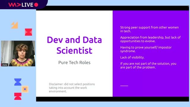
Introduction to technical background and geospatial roles

Joana Simoes · LIVE

2:21 min

Projecting external HTML content using default and named slots

Rowdy Rabouw Rowdy Rabouw · WWC 2022

2:10 min

Analyzing the out-of-the-box security posture of Vue.js

Philippe De Ryck · LIVE

2:29 min

Creating visual effects with Svelte animations and transitions

Markus Hatvan · LIVE

3:35 min

Essential web development prerequisites for building spatial applications

Desiree Santos Desiree Santos +1 · WWC 2024

6:12 min

Streaming HTML content natively using declarative processing instructions

Chris Heilmann +2 · LIVE

Videos

See all

Related articles

See all