


Geographic Information System (GIS) Coordinator

City of Westfield
Westfield, MA, United States
26 days ago
Apply on www.indeed.com
Prepare application

Role details

Contract type
Permanent contract
Employment type
Full-time (> 32 hours)
Compensation
$56,723.0 - $67,167.0
Working hours
Regular working hours
Job source

Tech stack

JavaScript (Programming Language) Geographic Information Systems AutoCAD Software Applications ArcGIS (Software) ArcSDE Bioinformatics Databases Relational Databases GIS Applications Global Positioning Systems (GPS) GPS EXchange Format
+8 more
Internet Protocol Python (Programming Language) Microsoft SQL Server MySQL Standard Sql Software Configuration Management Esri GIS (Software) Information Technology

Job description

Implementing, maintaining, troubleshooting, improving and expanding the city’s Geographic Information System (GIS) to meet the current and future needs of city departments and constituents. Maintenance and administration of engineering department relational databases and software applications. SUPERVISION: Works under general supervision of the City Engineer and may receive direction from the deputy engineer within authority. City Engineer is the appointing authority., The essential functions or duties listed below are intended only as illustrations of the various type of work that may be performed. The omission of specific statements of duties does not exclude them from the position if the work is similar, related or a logical assignment to the position.

  • Under general direction responsible for the maintenance and updating of the city’s Geographic Information System.
  • Implementing, managing, maintaining and expanding as needed GIS software including ArcGIS, ArcGIS Pro, ArcGIS Online, ArcGIS Enterprise, ArcGIS Field Maps, and ArcGIS Survey 123
  • Updates and edits GIS data layers as they relate to the City’s GIS including, but not limited to, sanitary sewer, water, stormwater, conservation, parcels and related engineering relational databases.
  • Provides support to GIS end users.
  • Collect, compile, analyze and digitize geospatial and tabular data, working with geospatial tools and technologies to produce maps and related products.
  • Convert hard-copy maps, plans, and records into digital ArcGIS datasets while maintaining data accuracy and integrity
  • Maintain technical files and GIS metadata documentation.
  • Must have the ability to understand user requests, interpret these requests and formulate responses that meet the users’ needs.
  • Provide end-user assistance with software requests, software configuration and projects, as needed. Coordinating with departments, IT staff, and vendors to solve problems.
  • Periodically update GIS data through use of GPS data collection and conversion of GPS data into GIS format.
  • Use of AutoCAD for viewing data and converting data into format compatible with GIS for the purpose of updating GIS.
  • Assists as requested in the process to interview, hire, train and supervise GIS interns.
  • Recommend software and hardware purchases for proper performance of GIS and engineering department systems.
  • Professional oral and written communication skills.
  • Production of end-of-year written summary/ annual report on GIS program.
  • Providing one-on-one and classroom style training to end-users on a regular basis.
  • Update City of Westfield website as needed and maintain database of usernames and passwords for the same.

Requirements

The ideal candidate will possess a minimum of a bachelor’s degree in civil engineering, geography, planning, computer science or related field. Experience supporting GIS applications is preferred. Any equivalent combination of education and experience which provides required knowledge, skills and abilities to perform the essential functions of the job may be considered., * Demonstrated proficiency with the ESRI family of products, including: ArcGIS Pro, ArcGIS Online, ArcGIS Enterprise, ArcGIS Field Maps, and ArcGIS Survey 123. Experience with enterprise geodatabases (formerly ArcSDE)

  • Knowledge of development, database, networking and internet technologies as they relate to GIS. Knowledge of GPS collection and conversion methods.
  • Knowledge of SQL, Python, and JavaScript and experience with relation database management systems such as SQL Server or MySQL a plus.
  • Ability to work cooperatively with general public and individuals of various backgrounds combined with ability to work independently with little direction when task requires it.
  • Ability to organize data into systems with an understandable, accessible format.
  • Ability to work within a structured system yet prioritize task to assure maximum efficiencies.

PHYSICAL, MOTOR, AND VISUAL SKILLS Physical Skills Ability to travel throughout office and Municipal Building to access other offices. Ability to operate a motor vehicle to access project sites. Must occasionally lift and/or move up to 80 pounds. Motor Skills The work requires motor skills for activities such as keyboarding, filing, moving objects and using a variety of office equipment and the ability to handle and manipulate small items. Visual Skills Visual demands require routinely reading documents for general understanding and analytical purposes. The City of Westfield is committed to maintaining a work environment free from discrimination on the basis of race, color, religion, national origin, pregnancy, gender identity, sexual orientation, marital/civil union status, ancestry, place of birth, age, citizenship status, veteran status, political affiliation, genetic information or disability, as defined and required by state and federal laws. Additionally, we prohibit retaliation against individuals who oppose such discrimination and harassment or who participate in an equal opportunity investigation.

Apply for this position

This job is hosted externally. Click below to view the full posting and apply.

Apply on www.indeed.com
Prepare application

Good distractions

Talks and stories from around this role — technically off-topic, practically not.

4:10 min

Introduction to technical background and geospatial roles

Joana Simoes · LIVE

1:54 min

Running heavy desktop graphics engines like AutoCAD on browsers

Önder Ceylan Önder Ceylan · World Congress 2024

2:18 min

Scaling MySQL databases for massive user growth

Johannes Nicolai Johannes Nicolai +1 · LIVE

1:23 min

Early implementations of WebAssembly across major industries

Niels Tanis Niels Tanis · World Congress 2023

1:48 min

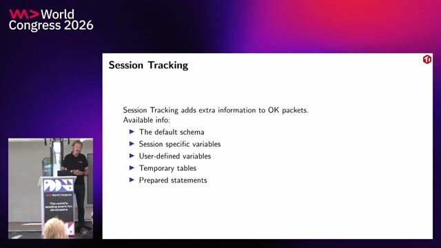
Analyzing network packets with database protocol tools

Daniël van Eeden Daniël van Eeden · World Congress 2026 Europe

1:15 min

Removing geographic filters to attract global software engineering talent

Antonia Eneh Antonia Eneh · World Congress 2026 Europe

Videos

See all

Related articles

See all