



Routing and Siting Lead GIS Analyst

Canacre USA, LLC
Spring, TX, United States
about 1 month ago

Role details

Contract type
Permanent contract
Employment type
Full-time (> 32 hours)
Experience level
Expert
Experience required
5 years minimum
Working hours
Regular working hours
Job source

Tech stack

Computer-Aided Design Geographic Information Systems Application Programming Interfaces (APIs) ArcGIS (Software) Batch Processing Network Analysis Data as a Services Information Engineering Data Integrity Extract Transform Load (ETL) Data Systems Relational Databases
+8 more
Python (Programming Language) Microsoft SQL Server Routing Quantum GIS (QGIS) Management of Software Versions Esri GIS (Software) Raster Graphics Surface Modeling

Job description

The Routing & Siting Lead GIS Analyst is a senior technical role responsible for the design, execution, and optimization of geospatial workflows supporting routing and siting studies for linear infrastructure and site development projects. This position requires deep expertise in spatial analysis, data engineering, with a strong focus on reproducibility, automation, and defensible analytical methodologies. You will lead the development and implementation of advanced geospatial models, constraint analyses, and suitability frameworks, while ensuring high data integrity, performance, and scalability across enterprise GIS environments. What You’ll Do:

  • Design and implement multi-criteria decision analysis (MCDA) models for route selection and site suitability.
  • Develop cost surface models, least-cost path analyses, corridor generation, and alternatives assessment workflows.
  • Integrate environmental, regulatory, engineering, and socio-economic datasets into constraint and opportunity mapping frameworks.
  • Document and maintain transparent, defensible methodologies aligned with regulatory and client requirements.
  • Architect and maintain enterprise geodatabases, data schemas, and versioning strategies.
  • Develop ETL workflows for ingesting, transforming, and validating large, multi-source spatial datasets.
  • Ensure data integrity through topology rules, domain constraints, and automated validation scripts.
  • Manage and optimize large raster and vector datasets, including DEMs, land cover, and remote sensing products.
  • Build and maintain automated geoprocessing workflows using Python (ArcPy), FME and ModelBuilder.
  • Develop reusable scripts and tools to support repeatable routing and siting analyses.
  • Implement batch processing pipelines for data updates, QA/QC, and reporting.
  • Support integration with APIs and external data services where applicable.
  • Produce high-quality cartographic outputs, technical figures, and map series suitable for regulatory submissions and client reporting.
  • Develop dynamic dashboards and web-based mapping applications to communicate analytical results.
  • Translate complex geospatial analyses into clear, technically accurate deliverables.
  • Perform other duties as required.

Requirements

  • Post secondary degree in GIS, Cartography, Geography, or related field of study, or equivalent experience.
  • Minimum 5-7 years professional experience in Routing and Siting.
  • Minimum 8-15 years professional experience in GIS.
  • Professional experience with ESRI ArcGIS and its extensions.
  • Extensive experience in routing and siting for linear infrastructure (e.g., pipelines, transmission, transportation, to support development of environmental assessments and permit applications for submittal to agencies requiring a Certificate of Convenience and Necessity).
  • Expert-level proficiency with ArcGIS Pro and ArcGIS Enterprise; experience with QGIS is an asset.
  • Professional Experience with: *

  • Least-cost path and network analysis
  • Remote sensing and terrain analysis
  • Spatial statistics and modeling
  • Strong experience with: *

  • Raster and vector analysis
  • Spatial modeling and suitability analysis
  • Large-scale geospatial data management
  • Proven experience developing automated GIS workflows and scripts (FME/Python/ArcPy).
  • Experience working with enterprise GIS environments and multi-user data systems.
  • Maintenance of SQL Server/Enterprise Database knowledge.
  • Professional experience with Experience Builder, Story Maps, Hub Sites, and other advanced Esri software is considered an asset.
  • Digitizing, editing, and performing queries in ArcGIS Pro, and relational databases.
  • Knowledge of regulatory frameworks and environmental constraints relevant to routing and siting.
  • Working knowledge of Microsoft Office 365.
  • Excellent written and verbal communication skills.
  • Excellent analytical and problem-solving skills.
  • Ability to lead others and train staff and clients in a professional manner.
  • A keen attention to detail.
  • An advanced understanding of the importance of projections, coordinate systems and datums.
  • An understanding of how to integrate CAD, KMZ/KML and GIS data.

Benefits & conditions

Pulled from the full job description

  • Tuition reimbursement
  • Pet insurance
  • Paid parental leave
  • AD&D insurance
  • Parental leave
  • Health insurance
  • Paid time off, * Competitive Compensation
  • Comprehensive Health Coverage - Multiple Medical, dental & vision plans with 100% preventive care
  • 24/7 telehealth (Teladoc)
  • Employee Assistance Program (EAP)
  • Company-funded HSA and pre-tax savings options
  • 401(k) Retirement Plan
  • No-cost Short- and Long-term Disability
  • Employer-paid basic Life & AD&D Insurance
  • Paid Time off (PTO) and 10 Paid Holidays
  • Paid Parental leave
  • Education Reimbursement and Professional Development
  • Employee discount program and optional insurance offerings:

  • Identity Theft Protection
  • Accident Insurance
  • Voluntary Life (spouse and child)
  • Critical Illness
  • Hospital Indemnity
  • Pet Insurance

About the company

Canacre’s core services focus on leadership in Environment and Land services throughout the project lifecycle. At Canacre, we emphasize continuous development and growth. Our commitment to investing in industry knowledge and the expertise of our teams sets us apart. Our goals are to provide technical leadership for greater regulatory understanding and certainty and to build collaborative relationships with stakeholders, mitigating tomorrow’s environment, land and right-of-way risks today. At Canacre, we act with honesty and integrity within a culture where trust, collaboration, and teamwork flourish. We commit to diversity, inclusivity and the celebration of successes. Our vision is to foster an environment that promotes inspired and empowered team members who make an impact. About this Role: Canacre’s core services focus on leadership in Environment and Land services throughout the project lifecycle. At Canacre, we emphasize continuous development and growth. Our commitment to investing in industry knowledge and the expertise of our teams sets us apart. Our goals are to provide technical leadership for greater regulatory understanding and certainty and to build collaborative relationships with stakeholders, mitigating tomorrow’s environment, land and right-of-way risks today. At Canacre, we act with honesty and integrity within a culture where trust, collaboration, and teamwork flourish. We commit to diversity, inclusivity and the celebration of successes. Our vision is to foster an environment that promotes inspired and empowered team members who make an impact.

Apply for this position

This job is hosted externally. Click below to view the full posting and apply.

Apply on indeed.com

Good distractions

Talks and stories from around this role — technically off-topic, practically not.

4:10 min

Introduction to technical background and geospatial roles

Joana Simoes · LIVE

2:04 min

Enhancing network privacy with routing fees and onion routing

Andreas M Antonopoulos · LIVE

2:37 min

Classifying and anonymizing data during system design

Reto Kaeser · LIVE

1:55 min

Maintaining software and data integrity during execution

Christian Wenz Christian Wenz · World Congress 2026 Europe

1:51 min

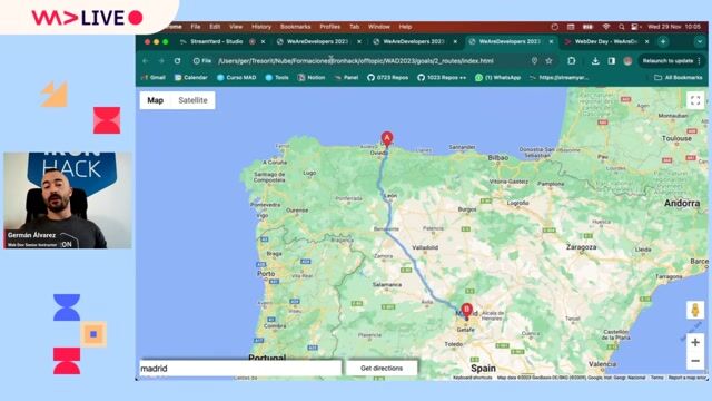
Overview of the three Google Maps routing applications

Germán Álvarez · LIVE

4:49 min

Discovering technical chart requirements via client use cases

Chris Heilmann +3 · LIVE

Videos

See all

Related articles

See all